Drone flight around Castle Ring, Cannock Chase
Castle Ring, on the edge of Cannock Chase, is an Iron Age hillfort which would have been built around 500 BC, believed to be a fortified settlement used by the Celtic Cornovii tribe. At its peak, it likely had roundhouses inside and acted as both a defensive stronghold and a local hub for the surrounding farming communities.
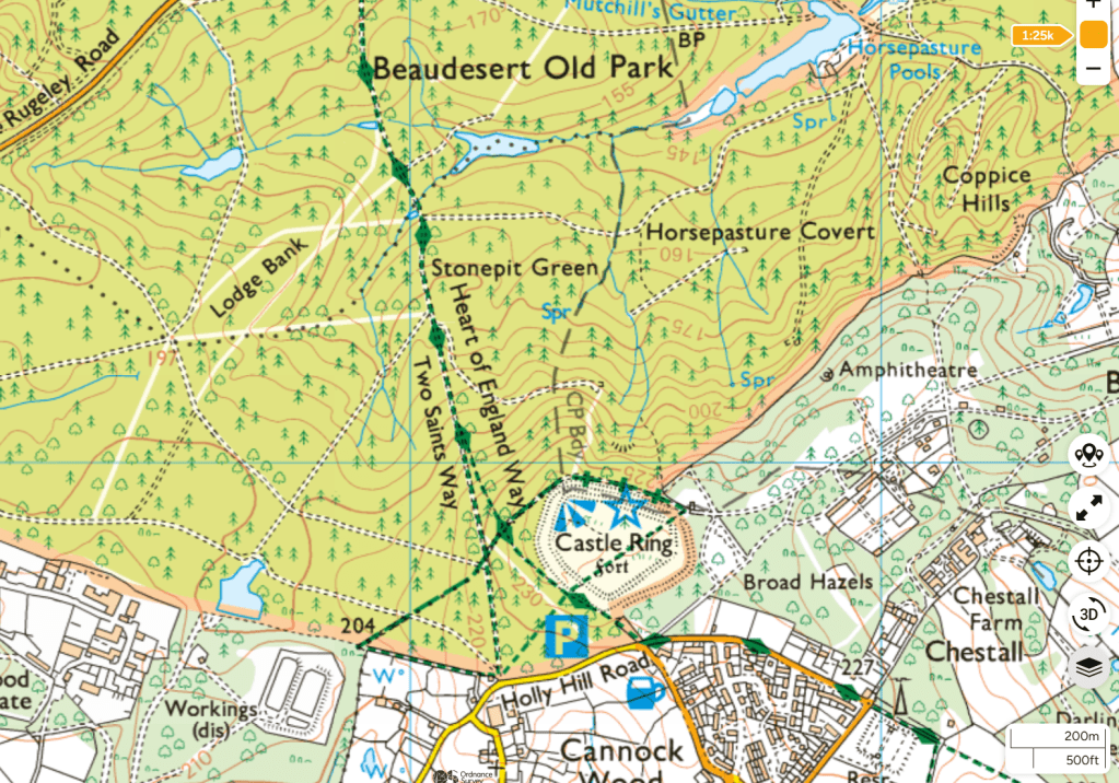
It’s the highest point on Cannock Chase at about 242 m (794 ft), ,and you get wide views over the Trent Valley and surrounding countryside
The whole site is free to explore, with paths running around the earthworks but don’t expect castle walls. What remains are mainly the earthworks including banks and ditches forming a roughly pentagonal enclosure with multiple defensive rings in places (called “multivallate”).
“This Green Flag Heritage Award winning site is over 2,000 years old and is set within Cannock Chase Area of Outstanding Natural Beauty. There are views over the Beaudesert Old Park and the Trent Valley area.” – Cannock Chase Council
Castle Ring can be found at the edge of the village of Cannock Wood. There is a large free car park, off Holly Hill Road and opposite the Park Gate Inn. For walkers, a circular route can be taken around the top of the monument via steps from the car park as well as further out on longer walks off into the adjoining Beaudesert Old Park and Cannock Chase as well as access to the Heart of England Way and Two Saints Way long distance walks.
Castle Ring is also a registered Earthcache published on geocaching.com.

Leave a comment