MIDLANDS MARILYNS – COUNTY TOPS – CHALLENGE WALKS – PEAK BAGGING (PEAK DISTRICT)
(Sorted by elevation)
Midlands Marilyns
A Marilyn is a hill or mountain in the British Isles and Ireland defined by having a drop of at least 150 metres/492 feet on all sides. The term was created as a playful counterpoint to Munro, the name given to Scottish mountains over 3000 feet, with Marilyn deliberately echoing the name Marilyn Monroe.
At present there are 1556 recognised Marilyns across the United Kingdom. Of these, 1218 are in Scotland, 174 in England, 159 in Wales and 5 on the Isle of Man.
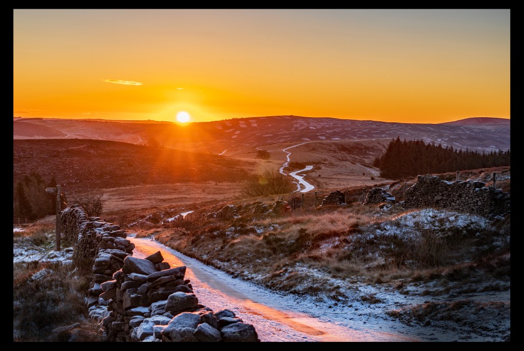
in 2025, I set about finding an achievable challenge for a newbie hill walker/hiker from the West Midlands, and so my Midlands Marilyn Challenge was born.
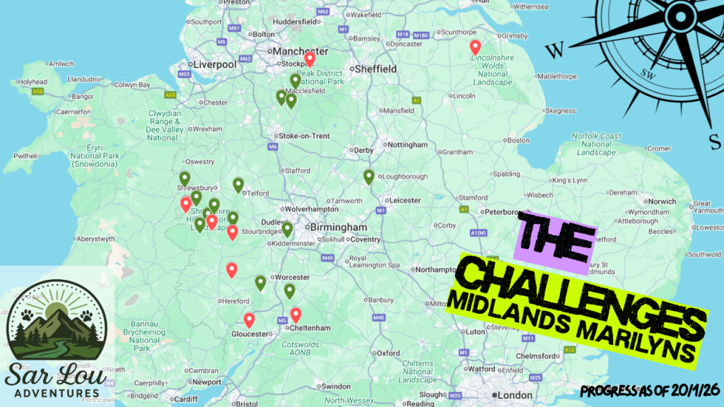
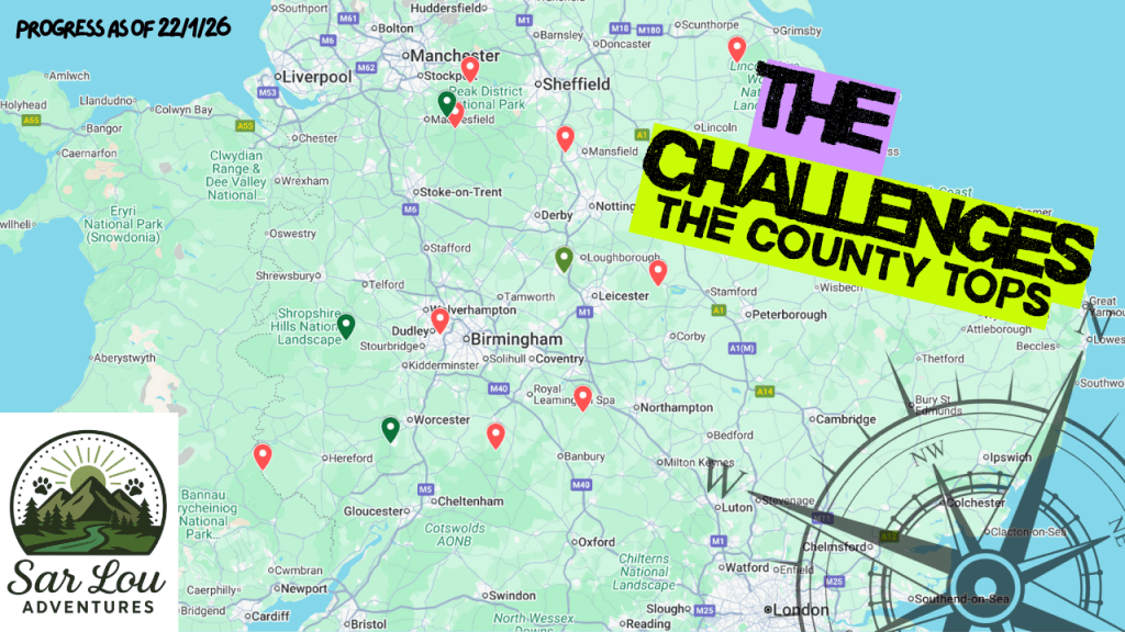
County Tops
County Tops are the noted highest points of everyone county within the United Kingdom. From just 22m in London (High Holborn) to a whopping 1345m in Scotland (Ben Nevis), the variety of locations can be a challenge in itself! I didn’t mean to set a County Tops challenge, but have been gaining them alongside my Marilyn Challenge so I though why not.
English County Tops
| HILL | ELEVATION | COUNTY | DATE COMPLETED |
| Cold Overton Park | 197m/640ft | Rutland | |
| Normanby Top [The Wolds] | 198m/551ft | Lincolnshire | |
| Newtonwood Lane | 205m/673ft | Nottinghamshire | |
| Arbury Hill | 225m/738ft | Northamptonshire | |
| Erbrington Hill | 261m/856ft | Warwickshire | |
| Turners Hill | 271m/889ft | West Mdlands | |
| Bardon HIll | 280m/918ft | Leicestershire | 08/11/2025 – View Blog |
| Malvern (Worcestershire beacon) | 425m/1395ft | Worcestershire | 30/10/2025 |
| Cheeks Hill | 520m/1706ft | Staffordshire | |
| Brown Clee Hill | 540m/1772ft | Shropshire | 30/11/2025 |
| Shining Tor | 559m/1834ft | Cheshire | 03/01/2026 |
| Kinder Scout | 636m/2087ft | Derbyshire | 21/02/2026 – View Blog |
| Black Mountain South Top | 637m/2090ft | Herefordshire |
Welsh County Tops
| HILL/MOUNTAIN | ELEVATION | COUNTY | DATE COMPLETED |
| Tair Onnen | 138m/453 ft | Vale of Glamorgan | |
| Merthyr Common | 231m/758 ft | Merthyr Tydfil | |
| Garth Hill | 307m/1,007 ft | Cardiff | |
| Wentwood | 309m/1,014 ft | Newport | |
| Mynydd y Betws | 373m/1,224 ft | Swansea | |
| Foel Cwmcerwyn | 537m/1,762 ft | Pembrokeshire | |
| Moel Famau | 555m/1082ft | Flintshire | 26/02/2026 – View Blog |
| Werfa (Mynydd Llangeinwyr) | 568m/1,864 ft | Bridgend | |
| Coety Mountain | 574m/1,883 ft | Torfaen | |
| Craig y Llyn | 600m/1,969 ft | Glamorgan | |
| Chwarel y Fan | 679m/2,228 ft | Monmouthshire | |
| Pomlumon Fawr | 753m/2,470 ft | Cardiganshire | |
| Fan Foel | 781m/2,562 ft | Carmarthenshire | |
| Craig Berwyn | 790m/2,592 ft | Wrecsam | |
| Moel Sych | 827m/2,713 ft | Montgomeryshire | |
| Pen y Fan | 886m/2,907 ft | Powys | 08/03/2026 – View Blog |
| Caernedd Llewellyn | 1062m/3,484 ft | Conwy | |
| Yr Wyddfa | 1085m/3,560 ft | Gwynedd |
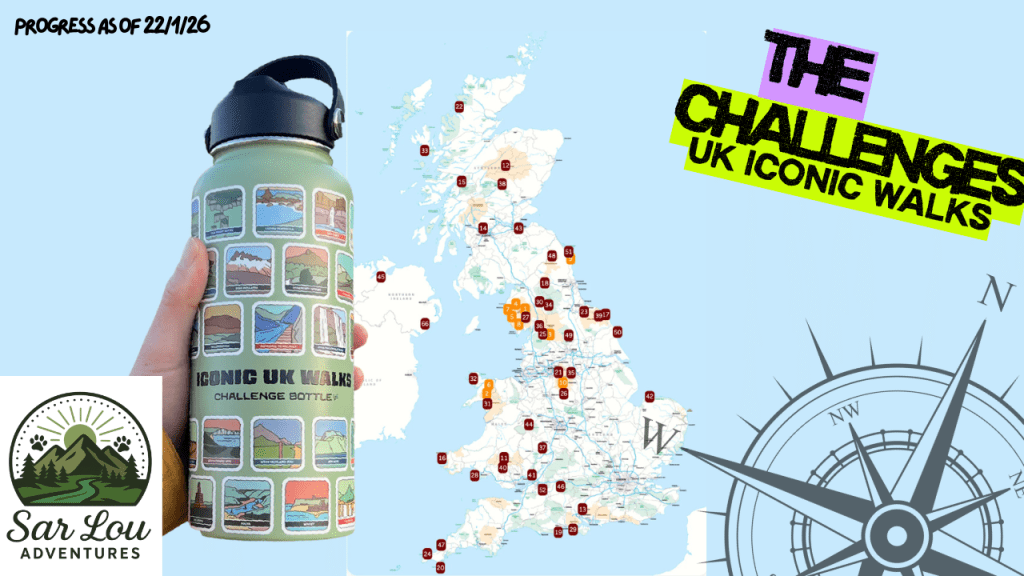
UK Iconic Walks
Peak Bagging (Peak District Ethels)
Comprised of 95 Ethel Hills located within the Peak District, ‘Peak Bagging’ draws on the region’s rich history as the UK’s first National Park (1951), with the “Ethels” created to honour pioneer of countryside protection Ethel Haythornthwaite. Connecting contemporary hillwalking challenges to historical figures and the area’s long cultural landscape, Peak Bagging has evolved from traditional climbing lists, high peaks over 400m and lesser but prominent hills known to form a much loved obsession for an ever growing population of hikers and runners.
| HILL | ELEVATION | DATE COMPLETED |
| Harthill Moor | 272m / 892ft | |
| Thorpe Cloud | 287m / 942ft | 14/10/2025 – View Blog |
| Lees Moor | 304m / 997ft | |
| Stanton Moor | 323m / 1060ft | |
| Bolehill (Cromford Moor) | 323m / 1060ft | |
| Fin Cop | 327m / 1073ft | |
| The Cloud | 343m / 1125ft | 11/12/2025 |
| Bole Hill (Burton Moor) | 356m / 1168ft | |
| Parkhouse Hill | 360m / 1181ft | |
| Musden Low | 361m / 1184ft | |
| Blakelow Hill (Bonsall Moor) | 367m / 1204ft | |
| Ecton Hill | 369m / 1211ft | |
| Tissington Hill | 369m / 1211ft | |
| Eccles Pike | 370m / 1214ft | |
| Wardlow Hay Cop | 370m / 1214ft | |
| Harland Edge (Beeley Moor) | 371m / 1217ft | |
| Minninglow | 372m / 1220ft | |
| Wetton Hill | 372m / 1220ft | |
| Lantern Pike | 373m / 1224ft | |
| Harborough Rocks | 379m / 1243ft | |
| Carder Low | 380m / 1247ft | |
| Crook Hill | 382m / 1253ft | |
| Gun | 385m / 1263ft | 29/12/2025 |
| Wolfscote Hill | 388m / 1273ft | |
| Longstone Moor | 395m / 1296ft | |
| Pilsbury Hill | 395m / 1296ft | |
| Aleck Low | 398m / 1306ft | |
| Revidge | 400m / 1312ft | |
| Croker Hill | 402m / 1319ft | |
| Cown Edge | 411m / 1348ft | |
| Black Hill (Whaley Moor) | 410m / 1345ft | |
| Gautries Hill | 410m / 1345ft | |
| Hen Cloud | 410m / 1345ft | |
| Sponds Hill | 413m / 1355ft | |
| Durham Edge (Abney Moor) | 416m / 1365ft | |
| Burton Bole (Shatton Moor) | 417m / 1368ft | |
| High Wheeldon | 422m / 1385ft | |
| Chrome Hill | 425m / 1394ft | |
| Sir William Hill (Eyam Moor) | 429m / 1407ft | |
| Grin Low | 430m / 1411ft | |
| Higger Tor | 434m / 1424ft | 06/11/2025 – View Blog |
| Corbar Hill | 437m / 1434ft | |
| Sough Top (Taddington Moor) | 438m / 1437ft | |
| Stanedge Pole (Stanage Edge) | 438m / 1437ft | 06/11/2025 – View Blog |
| Chelmorton Low | 446m / 1463ft | |
| Hollins Hill | 451m / 1480ft | |
| Foxlow Edge | 452m / 1483ft | |
| Chinley Churn | 457m / 1500ft | |
| White Path Moss | 457m / 1500ft | |
| High Neb (Stanage Edge) | 458m / 1503ft | |
| Ramshaw Rocks | 460m / 1509ft | |
| Win Hill | 462m / 1516ft | |
| Alphin Pike | 469m / 1539ft | |
| Eldon Hill | 470m / 1542ft | |
| Bradwell Moor | 471m / 1545ft | |
| High Edge | 472m / 1549ft | |
| Mount Famine | 473m / 1552ft | |
| Lose Hill | 476m / 1562ft | 13/11/2025 – View Blog |
| Slitherstone Hill | 477m / 1566ft | |
| Snailsden Pike End | 477m / 1566ft | |
| Merryton Low | 489m / 1604ft | |
| South Head | 494m / 1621ft | |
| Ashway Moss | 497m / 1631ft | |
| Dead Edge End | 499m / 1638ft | |
| Burbage Edge (Goyt’s Moss) | 500m / 1640ft | |
| West Nab | 500m / 1640ft | |
| Combs Head | 503m / 1650ft | |
| The Roaches | 505m / 1657ft | 28/10/2025 – View Blog |
| Shutlingsloe | 506m / 1659ft | |
| Black Edge (Combs Moss) | 507m / 1663ft | |
| Oliver Hill | 513m / 1683ft | |
| Mam Tor | 517m / 1696ft | 13/11/2025 – View Blog |
| Cats Tor | 518m / 1700ft | 03/01/2025 |
| Lost Lad | 518m / 1700ft | |
| Cheeks Hill (County top Staffordshire) | 520m / 1706ft | |
| Britland Edge Hill | 523m / 1716ft | |
| White Low | 530m / 1739ft | |
| Alport Moor | 535m / 1755ft | |
| Back Tor (Derwent Edge) | 538m / 1765ft | |
| Featherbed Moss | 541m / 1775ft | |
| Black Chew Head | 542m / 1778ft | |
| Featherbed Top | 544m / 1785ft | |
| Mill Hill | 544m / 1785ft | |
| Margery Hill | 546m / 1791ft | |
| Whetstone Ridge | 547m / 1794ft | |
| High Stones (Howden Edge) | 550m / 1804ft | |
| Lord’s Seat (Rushup Edge) | 550m / 1804ft | |
| Axe Edge Moor | 551m / 1808ft | |
| Shining Tor | 559m / 1834ft | 03/01/2025 |
| Brown Knoll | 569m / 1867ft | |
| Black Hill | 582m / 1909ft | |
| Grindslow Knoll | 601m / 1972ft | |
| Higher Shelf Stones | 621m / 2037ft | |
| Bleaklow | 633m / 2077ft | |
| Kinder Scout | 636m / 2087ft | 21/02/2026 – View Blog |
